Research Article, J Biodivers Manage Forestry Vol: 13 Issue: 2
Preliminary Reviving Spring Source Survey at Lunghar, Ukhrul District, Manipur
Ashem Rahul Singh*, Yengkokpam Satyajit Singh, Anilchandra Ahanthem, RajKumar Kishan Singh and Yumnam Lanchenba Singh
Department of Environment and Climate Change, University in Imphal, Imphal East, 795005, Manipur, India
*Corresponding Author: Ashem Rahul Singh
Department of Environment and
Climate Change, University in Imphal, Imphal East, 795005, Manipur, India,
Tel: 8974471989;
E-mail: benthhook@gmail.com
Received date: 31 January, 2023, Manuscript No. JBMF-23-88321;
Editor assigned date: 03 February, 2023, PreQC No. JBMF-23-88321 (PQ);
Reviewed date: 17 February, 2023, QC No. JBMF-23-88321;
Revised date: 18 April, 2023, Manuscript No. JBMF-23-88321 (R);
Published date: 25 April, 2023, DOI: 10.4172/2327-4417.10041
Citation:Singh AR, Singh YS, Ahanthem A, Singh RK, Singh YL (2023) Preliminary Reviving Spring Source Survey at Lunghar, Ukhrul District, Manipur. J Biodivers Manage Forestry 12:3.
Abstract
At this era, most springs are near threatened by the change of weather patterns. We are observing the drying of springs in every part of the hill’s districts. As a result, there is chances of losing the ecological balance of surrounding environment, both the floral and faunal species including humans. We are late but still have time to maintain and restore the incredible services that springs anchor. The directorate of environment and climate change is organizing the six-day spring source survey at Lunghar village, Ukhrul district, around 114 kms from the capital Imphal in collaboration with the ACWADAM, ICIMOD,PSI and SDC. The village is supplying drinking water to the Ukhrul headquarter from the springs comes from the Phangrei mountain range. This is the reason for giving greater emphasis on selecting Lunghar village for the pilot study. There are around 25 springs present under the jurisdiction of Lunghar village.
Keywords: Springs, Threatened, Drying, Restore; Survey, Lunghar
Introduction
Basically, springs are known by various names in different parts of the Indian sub-continent, dhara in Uttarakhand and Sikkim, chasma in Jammu and Kashmir, chumiks in Tibet and Ladakh, jhoda in Bengal and jhara in Maharashtra [1]. In Manipur, we called the springs as eefut. Studies suggests that important major river like the Ganga, Krishna, Godavari, Narmada and other small rivers starts their journey from the springs [2]. In addition, springs provide fresh water to numerous streams, lakes, wetlands etc. [3]. More importantly, freshwater springs support the surrounding ecosystems, wildlife and reflect the health of aquifers [4]. The capacity of the aquifer to store and transmit groundwater directly reflects in the nature of spring discharge [5]. On the other, declining of spring water leads to the disturbance of ecological system and services, including the floral and faunal diversity. In the country, most springs support many of the rural and urban livelihoods as water supply schemes originates from the nearby spring source [6].
The district: Ukhrul
The district Ukhrul had a total geographical area of 4544 Sq.km, which was then the 2nd largest district in the state before Kamjong district was curved out. The district is located at an altitude range of 913 m to 3114 m (MSL) and lies between 24°29′ and 25°42′ N latitude and 94°30′ E and 94°45′ E longitude (including Kamjong district) [7]. The climate of Ukhrul district is sub-tropical monsoon type with a temperate nature. A slow trend of variation in the climatic condition of the district has been observed. The total annual rainfall in 2020 was found to be 1342.6 mm while it was 2326.2 mm in 2018 mm and 3369.8 mm in 2017 [8]. As the district headquarter lies on the top of the high hills, the hill range that lies in the district headquarter Ukhrul central sub-division has got very cold climate in winter while other parts of the vast hilly areas of the district have got moderate climate throughout the year. A minimum and maximum temperature of 1.7°C to 27.98℃ has been recorded in 2020 while it was 2.5°C and 32.3°C was in 2018 and 4.41℃ and 29.7℃ respectively in 2015. The coldest months of the district are December and January. According to the historical trends and climate change projections for the district of Manipur, the annual rainfall conditions in the district has increased by over 5% (1987 to 2016). The rainfall variability (coefficient of variability) is high (>40% in according to the historical trends report. Under the RCP 8.5 scenario, the increase in rainfall of >35% is project in Ukhrul. The lowest mean rainfall during JJAS was recorded in Ukhrul district with 724 mm [9].
Trends of temperature in Ukhrul district
The summer and winter minimum temperature in Ukhrul district have increased during the historical 30 years period. The entire district of Ukhrul have warmed by 0.75 degree celsius when the winter maximum temperature is considered. The mean kharif rainfall in the district ranged from 724 mm. According to the historical climate trends and climate change projections, there is short term (2030's) and long term (2080's) of temperature increase in the Ukhrul district. In the short term, warming of summer temperature in the range of 1℃ to 2℃ with >1.5℃ warming is projected in the district. While in the long term period, there is little chances of warming as projection [10].
Forest cover
According to the India State of Forest Report (ISFR) 2021, the district has a total forest cover of 3,623.75 sq. km which is 79.75% of its total geographical area, of which 194.61 sq.km comes under very dense forest, 1,241.22 sq.km under moderately dense forest and 2,187.92 sq.km under open forest area (Table 1). The total forest cover showed a slight declined from the ISF report of 2017 which had a total forest cover area of 3706 sq.km.
| Category as per 2021 assessment | Value |
|---|---|
| Geographical area | 4544 |
| Total forest area | 3623.75 |
| % Forest covered of the Total Geographical Area (TGA) of Ukhrul district | 79.75 |
| Change with respect to 2019 assessment | -41 |
| Scrub | 356.26 |
| Very dense forest | 194.61 |
| Moderately dense forest | 1241.22 |
| Open forest | 2187.92 |
Table 1: Forest coverage is Ukhrul district.
Materials and Methods
Study area: Lunghar village
Lunghar village is located on the Eastern Himalayan forest type. The village name ‘Lunghar’ comes from the Meitei word ‘Nunghar’. Nung means stone whereas Har is to dig out. The village is the home of Tangkhul Naga tribe. Majority of the inhabitants are Christians. The village is classified into four tangs (cluster) namely, Leiyin Tang (100), Soso Tang (110), Huisuinao Tang (80) and Asai Tang (150) which comes together to total household of 450. According to the 2011 census, the total population of the village is 1917, out of which 943 are male and 974 are female. The average sex ratio is 1033 female to 1000 male which is higher than the state average of 985. The literacy rate of the village stands at 71.99%. Male literacy rate stands at 78.16% while female literacy rate is 66%. Most villagers depend on agriculture for their livelihood. Some of the vegetable crops cultivated in the village are cabbage, cauliflower, peas, cow pea, maize, potato and other climber species. The people believed that the presence of chromite make possible the most fertile village in comparison to other villages in the whole district [11]. However, paddy is the major crop produces in the district. The local crop ‘phourel’ is planted in the village. The people followed their own traditional way of agricultural practices. In the essentially agrarian economy of the district, animal husbandry is an important source of income. Important livestock found in the district are cattle, poultry, pigs, dogs, buffaloes etc. They are reared for meat and for motive power in cultivation works. Fowls and ducks are the most important poultry of the village [12].
Mapping of spring source and number of hydrant in Lunghar village
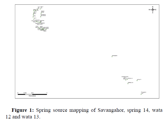
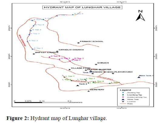
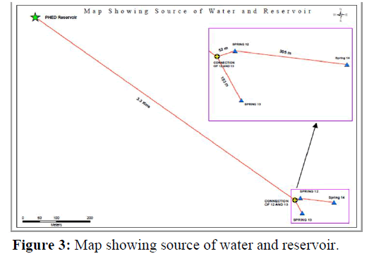
Hydrogeological mapping of the springs often reveals that the recharge and protection areas of the springs are very site specific (Figure 1). The extent and location of these areas can be indirectly correlated to the spring type and nature of discharge (Figure 2). The extent and location of these areas are governed by the local geology and structure present and not by the administrative boundaries or type of land viz., private, common, agricultural, forest etc. (Figure 3).
Foral species at spring site
The village is mostly covered by private forest, both conserve and for agricultural purposes (Table 2). Microcos paniculata (Heitup) is one edible fruit species grown in the village orchard. Some tree species growing inside the village are Alnus nepalensis (Pareng), Quercus pachyphylla (Kuhi) and Quercus dealbata (sahi), Grevilla robusta (Kouvilla), Acacia spp., Eucalyptus spp. (Nasik) etc. Recently, the village starts growing of Psidium guajava (Pungton) and Citrus spp. (Champra). Most species found in the spring site are similar to each other. There is no animal sighting on the spring area. Some domestic buffaloes are grazing on the Phanggrei lake (25 8 52.7; 94 28 3.5).
| S. no | Tree species | Local name | |
|---|---|---|---|
| 1 | Alnus nepalensis | Pareng | |
| 2 | Albizzia procera | Khal | |
| 3 | Albizzia lebbeck | Uil | |
| 4 | Cedrela toona | Tairel | |
| 5 | Melia azaderach | Seijrak | |
| 6 | Quercus pachyphylla | Kuhi | |
| 7 | Quercus dealbata | Sahi | |
| 8 | Artocarpus spp. | Cham | |
| 9 | Pinus kesia | Uchaan | |
| 10 | Castanopsis hystrix | Thangji | |
| 11 | Bischofia javanica | Uthum | |
| 12 | Bambusa bamboos | Wa | |
| 13 | Rhododendron spp. | Ching lei | |
| 14 | Cedrela serrata | Tairel | |
| 15 | Cinnamomum spp. | Usingsha | |
| 16 | Ficus hispida | Ashi heibong | |
| 17 | Holiadrana longifolia | Kherai | |
| 18 | Juglans regia | Heijukak | |
| 19 | Machilus villosa | Uningthou manbi | |
| 20 | Melia azaderach | Seijrak | |
| 21 | Michelia champaca | Leihao | |
| 22 | Magnolia spp. | Uthambal | |
| 23 | Pterospermum acerifolium | NIL | |
| 24 | Rhus sinensis | Heimang | |
| 25 | Sterospermum chelonoides | Missi | |
| 26 | Phoebe haisisiana | Uningthou | |
| 27 | Duabanga sonneratiodes | Tal | |
| 28 | Amoora wallichii | Rata | |
| 29 | Gmelina arborea | Wang | |
| 30 | Spondias pinnata | Heining | |
| 31 | *NIL | Sairen | |
| 32 | *NIL | Lunghu | |
| 33 | Salix tetrasperma | Uyung |
*NIL: Unidentified local tree species.
Table 2: The important tree species growing in the study area.
Instrument
• GPS device.
• Water bucket and stop watch.
• All in one, PH, EC, TDS, salt, temperature, portable meter.
• Social and natural resource map.
• AWS.
• Flume system.
Materials collection
• Collection of review literature, published journal and unpublished reports.
• Random household survey and oral interview related to temperature and rainfall in the study area.
• Studies on weather reports of study area collected from the directorate of environment and climate change, Manipur.
Result and Discussion
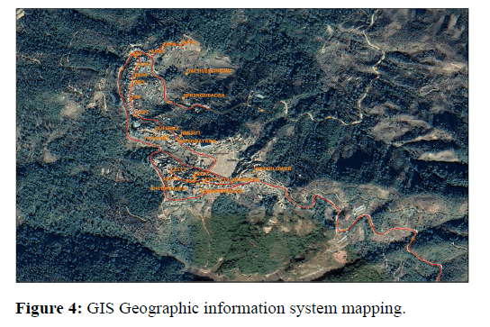
The broad objective is to examine the fourteen springs site at Lunghar (Figure 4). Most springs support the livelihoods of Ukhrul district as water supply schemes originates from the nearby spring source (Table 3). At present, many springs are threatened by water use, erratic rainfall or no rainfall, drought and climate variability and change. Drying of springs, streams and even rivers become a common scenario in every part of the hilly regions (Table 4). As the springs site is far from the village, the work burden of women is another addition since they are forced to manually carry water from springs below their village during the lean season. Several other factors behind the drying up of springs are due to environmental factors, land cover and changes in land use pattern, socioeconomic and demographic changes. The above reasons lead to insecurity of drinking and domestic water in the rural and urban areas, lack of irrigation water in the hills and poor ecosystem services. More focus must be given on physical, biological and social involvement in order to ensure water security and livelihoods in the long term. In small state like Manipur, most spring flow is adversely affected by ecological degradation, changing land use, exploitation and climatic factors (Table 5). However, there is a significant data gap in the understanding of spring water flow dynamics, watershed related linkages, characteristics of local springs, and the factors leading to their decline in the Himalayan region. Springs and their significance for water security in the Himalayas remain poorly understood, as do the livelihood implications of changes, and springs are generally overlooked in matters of administration and conservation. At present, the concept of ‘Springshed’ management is gaining significance and could add value and an important layer to conventional ‘watershed’ management approaches.
Moreover, the quality of spring water needs to be check on time to time in order to prevent from the harmful contamination. A combination of advanced scientific methods and social engineering studies need to be carried out at the micro-watershed level to establish strong linkages between groundwater flows (hydrogeology), recharge areas, and springs distribution and patterns based on the rock types and geology. Aquifers need to be considered as an integral part of ecosystem as it helps in the maintenance of spring-shed in natural settings as well as human manipulated situations (Table 6).
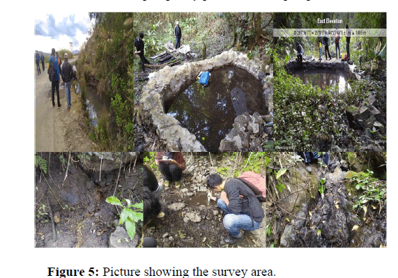
Spring revival will contribute to improving water security in mountain towns and cities and will also help in providing safe water thus contributing toward meeting commitments under the Sustainable Development Goals (SDGs) especially SDG 6. Thus, link to SDGs could facilitate multi-stakeholder (Figure 5).
| S. no | Springs name | Ownership | Use | Type of spring | Coordinates | Elevation |
|---|---|---|---|---|---|---|
| 1 | Savangahor | Community | Agriculture, horticulture | Contact, perennial | 25 09 48.84 | 1894 |
| 94 27 16.39 | ||||||
| 2 | Wata 3 | Community | Drinking, domestic | Fracture, perennial | 25 09 7.40 | 2102 |
| 94 28 1.40 | ||||||
| 3 | Wata 1 | Community | Drinking, domestic | Stream form, perennial | 25 09 10.47 | 1976 |
| 94 27 48.16 | ||||||
| 4 | Wata 2 | Community | Drinking, domestic | Stream form, perennial | 25 09 5.16 | 1989 |
| 94 27 49.45 | ||||||
| 5 | Sanaochip | Community | Agriculture, horticulture | Depression, perennial | 25 10 5.13 | 1964 |
| 94 26 59.29 | ||||||
| 6 | Ngaparashuwa | Community | Agriculture, horticulture | Depression, perennial | 25 10 1.68 | 1995 |
| 94 27 5.01 | ||||||
| 7 | Shingribungra | Community | Agriculture, horticulture | Depression, perennial | 25 09 50.23 | 1883 |
| 94 27 16.62 | ||||||
| 8 | Shingribungra 2 | Community | Agriculture, horticulture | Depression, perennial | 25 09 50.93 | 1888 |
| 94 27 19.39 | ||||||
| 9 | Turiawarahu | Private | Agriculture | Depression, perennial | 25 10 22.7 | 1818 |
| 94 26 23.0 | ||||||
| 10 | Maharra | Community | Agriculture, domestic | Depression, perennial | 25 10.39 23.51 | 1796 |
| 94 26.26 15.64 | ||||||
| 11 | Hurira | Community | Agriculture, fishery, domestic use | Depression, perennial | 25 10.42 30.1 | 1783 |
| 94 26.26 12.7 | ||||||
| 12 | Hurira 2 | Community | Agriculture, domestic | Depression, perennial | 1804 | |
| 13 | Gachuira | Community | Agriculture, domestic | Depression, perennial | 25 10 29.66 | 1736 |
| 94 26 12.19 | ||||||
| 14 | Hurngao | Community | Domestic | Depression, perennial | 25 07 55.23 | 1999 |
| 94 27 49.53 |
Table 3: Springs identification and types.
| S. no | Springs name | Discharge (L/min) | Ph | Electrical conductivity (Microsiemens) | Total dissolved solid (ppm) | Salinity (ppm) | Temperature (degree Celsius) | Bacteria contamination | Geology properties | |
|---|---|---|---|---|---|---|---|---|---|---|
| Dip of angle | Dip direction | |||||||||
| 1 | Savangahor | 20 | 7.9 | 216 | 277 | 187 | 20.2 | No (Single test) | 46 | 100 N |
| 2 | Wata 3 | 8 | 8.24 | 161.4 | 115 | 76.4 | 15.7 | 25.15 | 94.46 N | |
| 3 | Wata 1 | 100 | 8.4 | 111 | 235 | 167 | 15.2 | |||
| 4 | Wata 2 | 200 | 8.06 | 100 | 213 | 151 | 15 | |||
| 5 | Sanaochip | 3.57 | ||||||||
| 6 | Ngaparashuwa | 5 | 8.34 | 361 | 256 | 171 | 16.2 | |||
| 7 | Shingribungra | 13 | 8.44 | 308 | 219 | 145 | 14.9 | |||
| 8 | Shingribungra 2 | 15.17 | 8.15 | 331 | 235 | 155 | 14.1 | |||
| 9 | Turiawarahu | 1.83 | 6.84 | 256 | 156 | 116 | 15.1 | |||
| 10 | Maharra | 14.18 | 6.21 | 120.4 | 85.6 | 57.5 | 14.2 | |||
| 11 | Hurira | 10 | 6.2 | 286 | 203 | 135 | 15.6 | |||
| 12 | Hurira 2 | 1.34 | 7.27 | 311 | 221 | 147 | 16.6 | |||
| 13 | Gachuira | 5.31 | 6.6 | 298 | 212 | 141 | 16.1 | |||
| 14 | Hurngao | 75 | 8.37 | 224 | 159 | 105 | 13.4 | |||
Table 4: Water qualities of the springs.
| S. no | Water tank name | Source of water | Water supply area | Timing | |
|---|---|---|---|---|---|
| Morning | Evening | ||||
| 1 | Lunghar water supply near tower | Wata 1 and Wata 2 | Sosotang, Huisuinaotang, Asaitang | 4.307.30 | 4-5 |
| 2 | Leiyin tang distribution tank | Reservoir tank near veterinary office | Leiyin tang | ||
| 3 | Jorcheng water supply | Hurngao spring | Not functioning | ||
| 4 | Reservoir tank near veterinary office | Hurngao spring | Leiyin tang and LBC church tank | ||
Table 5: Water supply tank.
| S. no | Parameters | Result (water reservoir and springs) | ||
|---|---|---|---|---|
| 1 | Ph | 7.3 | 7.3 | 7.2 |
| 2 | Temperature (degree Celsius) | 22 | 19.5 | 19.5 |
| 3 | Free carbon dioxide (mg/l) | 5.5 | 0.3 | 0.25 |
| 4 | Dissolved oxygen (mg/l) | 7.24 | 6.64 | 7.65 |
| 5 | BOD (mg/l) | 0.885 | 0.9 | 0.6 |
| 6 | COD (mg/l) | 8 | 12 | 12 |
| 7 | Hardness (mg/l) | 114 | 108 | 110 |
| 8 | Calcium (mg/l) | 7.21 | 3.82 | 8.2 |
| 9 | Magnesium (mg/l) | 106.79 | ||
| 10 | Chloride (mg/l) | 5.68 | 8.52 | 7.1 |
| 11 | Alkalinity (mg/l) | 135 | 3.1 | 3.2 |
| 12 | Inorganic phosphorous | 0.17 | 0.098 | 0.078 |
Table 6: Water sample quality parameter for spring 12.
Conclusion
Looking into spring shed management is one important factor to community level water management systems at this era. It has the potential to change the perception of springs from a ‘source’ to a ‘resource’. In order to make local spring and groundwater management institutions more effective, there is an urgent need to define water policy. Formal as well as informal institutions need to take part in this. The establishment of tradable private property rights in spring water would be a major institutional reform. This could also empower communities to establish rights over the water they manage and address the issues of efficiency, equity, and sustainability. The need of time is to generate a comprehensive data or inventory for the springs and prioritized them for its management.
• Identifying vulnerable village in the hill’s districts of Manipur.
• Spring name and number of peoples dependent on that spring.
• GPS location of the spring.
• Seasonal, perennial etc.
Advanced scientific methods and social engineering studies need to be carried out at the micro-watershed level to establish strong linkages between groundwater flows (hydrogeology), recharge areas, and springs distribution and patterns based on the rock types and geology. Aquifers need to be considered as an integral part of ecosystem as it helps in the maintenance of spring-shed in natural settings as well as human manipulated situations.
The way forward
• Traditional wisdom is one method to revive the springs in the long
term.
• Hydrogeological mapping of the springs.
• Spring inventory in other hills site of the state.
• Finding the data gap of spring water flow dynamics, watershed
related linkages, characteristics of local springs.
Acknowledgement
The authors are grateful to Dr. Himanshu Kulkarni, Mr. Md Imran Siddique, Ms. Simran Sumbre (ACWADAM); Dr. Ghanashyam Kharel (SDC); Mr. Madhav Dhakal (ICIMOD), Rajesh Kumar (PSI) and IIT-Roorkee for providing guidance and inputs to carry out this task. Thanks are due to the IHR under the Swiss agency for Development and Cooperation (SDC) supported project on Strengthening Climate change Adaptation in Himalayas (SCAHimalayas). Acknowledgements are also due to officers from Line department viz. water resource department, forest department, hills and tribal affairs department, agriculture department and horticulture department, CRPs (Community Resource Persons) from Mountain Indigenous Knowledge Center (MIKC), VVD and participants from community leaders, church leaders, NGOs, etc. one/two each from each hill districts. I personally thank to Lamabam Nganba for the GIS mapping. Special thanks to the people of Lunghar village for their kindly help during the course of survey.
References
- Hotos GN (2021) A preliminary survey on the planktonic biota in a hypersaline pond of Messolonghi Saltworks (W. Greece). Diversity 13:270.
- Chouvy PA, Afsahi K (2014) Hashish revival in Morocco. Int J Drug Policy 25:416-423.
[Crossref] [Google Scholar] [PubMed]
- Furlong MJ, You S, Renshaw TL, Smith DC, O'Malley MD (2014) Preliminary development and validation of the social and emotional health survey for secondary school students. Soc Indic Res 117:1011-1032.
- Albrecht C, Wilke T (2008) Ancient Lake Ohrid: Biodiversity and evolution. Hydrobiologia 615:103-140.
- Macdonald DW, Tattersall FH, Brown ED, Balharry D (1995) Reintroducing the European beaver to Britain: Nostalgic meddling or restoring biodiversity?. Mammal Review 25:161-200.
- Prober SM, Thiele KR, Lunt ID, Koen TB (2005) Restoring ecological function in temperate grassy woodlands: Manipulating soil nutrients, exotic annuals and native perennial grasses through carbon supplements and spring burns. J Appl Ecol 42:1073-1085.
- Azhoni A, Goyal MK (2018) Diagnosing climate change impacts and identifying adaptation strategies by involving key stakeholder organisations and farmers in Sikkim, India: Challenges and opportunities. Sci Total Environ 626:468-477.
[Crossref] [Google Scholar] [PubMed]
- Roni P, Beechie TJ, Bilby RE, Leonetti FE, Pollock MM, et al. (2002) A review of stream restoration techniques and a hierarchical strategy for prioritizing restoration in Pacific Northwest watersheds. N Am J Fish Manag 22:1-20.
- Silvano RA, Udvardy S, Ceroni M, Farley J (2005) An ecological integrity assessment of a Brazilian atlantic forest watershed based on surveys of stream health and local farmers' perceptions: Implications for management. Ecol Econ 53:369-385.
- Harris RB (2010) Rangeland degradation on the Qinghai-Tibetan plateau: A review of the evidence of its magnitude and causes. J Arid Environ 74:1-2.
- Kleijn D, Sutherland WJ (2003) How effective are European agri‐environment schemes in conserving and promoting biodiversity?. J Appl Ecol 40:947-969.
- Ge P, Dawson VL, Dawson TM (2020) PINK1 and Parkin mitochondrial quality control: A source of regional vulnerability in Parkinson’s disease. Mol Neurodegener 15:1-8.
[Crossref] [Google Scholar] [PubMed]
 Spanish
  Chinese
  Russian
  German
  French
  Japanese
  Portuguese
  Hindi
Hindi 